Live camera
Whakatane coast live camera — North Island
A monitoring camera looking from the Bay of Plenty shore out towards Whakaari (White Island).
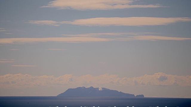 Sample August 2026
What you are looking at
A GeoNet camera on the Whakatane coast, in the Bay of Plenty, watching out toward Whakaari (White Island) offshore. The sea fills the foreground; the island sits on the horizon at the back of the frame.
Whakaari is an active volcanic island some fifty kilometres off this coast. Only the top of the mountain is above water — most of it is below the sea. On 9 December 2019, with tourists and guides ashore, a steam eruption killed many of them. Nobody has landed since. Two cameras watch this bearing precisely so the plume can be measured without sending anyone to the island.
Whether the island is visible at all comes down to the day's visibility. At that distance, a slight haze is enough to empty the horizon. The day after strong wind has turned the air over tends to give the longest view.
Sulphur was mined on the island until 1914. In that year part of the crater wall gave way and all ten workers were killed; the only survivor, the story goes, was the camp cat. That ended the mining, but the island has been in private ownership since 1936, which is an unusual arrangement for a volcano. Whakaari is the northern end of the Taupo Volcanic Zone, a belt that runs south in one line from the sea through Tongariro and Ruapehu. Nearly all of the New Zealand cameras on this site stand somewhere along it.
Opening it between early morning and midday Japan time catches the brightest part of the local day.
About this camera
| Place | North Island |
| Format | Still, every 10 min |
| Time zone | Pacific/Auckland (UTC+12, DST UTC+13) |
| Category | Volcano · Sea |
| Operator | GeoNet New Zealand |
| Terms of use | CC BY 3.0 NZ |
The operator's own page
The footage belongs to each agency. This site is an unofficial guide, and each sample frame was copied once per camera under that agency's terms of use.
Cameras nearby
- Raoul IslandKermadec IslandsStill, every 10 min
- Mount Ruapehu, eastNorth IslandStill, every 10 min
- Mount Ruapehu, southNorth IslandStill, every 10 min
- Te Maari craters, Mount TongariroNorth IslandStill, every 10 min
- Mount NgauruhoeNorth IslandStill, every 10 min
- Ngauruhoe and TongariroNorth IslandStill, every 10 min
- Te Kaha coastNorth IslandStill, every 10 min
- Mount TongariroNorth IslandStill, every 10 min