Live camera
Mount Kurikoma live camera — Iwate / Miyagi / Akita border
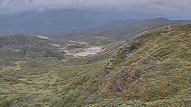
A volcano on the border of Iwate, Miyagi and Akita, updated every two minutes by the Japan Meteorological Agency. A pale blue pond sits in a hollow among the green slopes. Autumn colour runs from late September into October, working down the slope from the top.
 Sample August 2026
What you are looking at
One of the volcanoes the Japan Meteorological Agency keeps under constant watch. At 1,626 metres, it straddles three prefectures: Iwate, Miyagi and Akita.
Straddling three prefectures also means no single prefecture's page can hold all of it. The ridgeline is the border, so the left and right of the frame fall under different administrations.
The pale blue pond in the hollow on the green slope was made by an eruption. On 20 November 1944 mud was thrown out here, the Iwai River downstream ran turbid and fish died in numbers. Water then collected in the hollow and became a pond, named Showa-ko after the era of that year. The pond in the frame, in other words, has a known birth year.
The autumn colour from late September into October is intense. Colour descends from the high ground, so you can watch the mountainside change from the top down. The usual peak is early October, but it shifts by one to two weeks from year to year and runs late after a summer whose heat lingers.
Mornings are better. In September and October cloud builds before noon, so on many days the only clear spell is early. Low, angled light also deepens the colour. The day after rain, dust has been washed out of the air and you see further. A still image, refreshed every two minutes.
About this camera
| Place | Iwate / Miyagi / Akita border |
| Format | Still, every 2 min |
| Time zone | Asia/Tokyo (UTC+9) |
| Category | Volcano · Nature |
| Operator | Japan Meteorological Agency — volcano surveillance cameras |
| Terms of use | PDL 1.0 |
The operator's own page
The footage belongs to each agency. This site is an unofficial guide, and each sample frame was copied once per camera under that agency's terms of use.