Live camera
Tenjin River, field office live camera — Tottori
The Tenjin River, which crosses the Kurayoshi plain and reaches the Sea of Japan, filmed from the ministry's field office beside it.
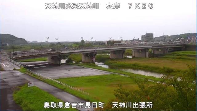 Sample September 2026
What you are looking at
The sample came from the ministry field office in Kurayoshi, Tottori, and the text read left bank 7K20 on the Tenjin River. The view looks down from a height: a white car crosses a long road bridge, and a broad mown floodplain fills the foreground. The flow itself is a narrow thread over to the right, with the town along the far bank.
The burned-in distance is written two different ways on these streams. Here it is broken with a K, as in 7K20, while other points write it as a decimal, as in 25.170k. Both mean the same thing: kilometres from the mouth.
Because the floodplain is wide and mown, the edge of the grass tells you how far the water has come. On an ordinary day only a small part of that width is in use.
The part of Kurayoshi spread out on the far bank is where the provincial seat of Hoki was placed in ancient times. The tributary that joins the Tenjin here, the Kokufu, is named after that office. What the plain once was survives in the name of a river.
Use it in heavy rain. The two tributary cameras move first and this main-stem point follows. Decide about evacuating by what your local authority says.
About this camera
| Place | Tottori |
| Format | Live video |
| Time zone | Asia/Tokyo (UTC+9) |
| Category | River |
| Operator | MLIT river live streams |
| Terms of use | Government Standard Terms 2.0 |
The operator's own page
The footage belongs to each agency. This site is an unofficial guide, and each sample frame was copied once per camera under that agency's terms of use.
Cameras nearby
- Bewick's swans, Yonago Waterbird SanctuaryYonago, TottoriStill, hourly
- Mount Karasugasen from KagamiganaruKofu, TottoriStill, hourly
- Ogamo River gaugeTottoriLive video
- Ko River gaugeTottoriLive video
- Hino River, lower gaugeTottoriLive video
- Hosshoji River gaugeTottoriLive video
- Hino River, upper gaugeTottoriLive video
- Sendai River, lower gaugeTottoriLive video