Live camera
Mount Yake live camera — Nagano / Gifu border
Standing just south of Kamikochi. The 1915 eruption dammed the Azusa River and created Taisho Pond. Steam still rises near the summit.
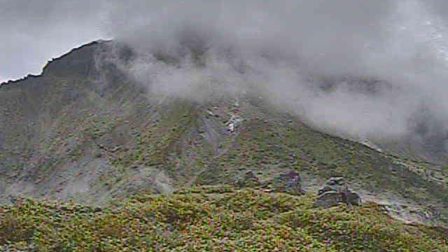 Sample August 2026
What you are looking at
One of the volcanoes the Japan Meteorological Agency keeps under constant watch. It stands just south of Kamikochi, and steam still rises near its summit.
This volcano made the scenery of Kamikochi itself. What it erupted in 1915 dammed the Azusa River, and Taisho Pond formed among the drowned trees. The dead trunks still standing in the water date from then. The pond most visitors to Kamikochi see first was made by this mountain roughly a century ago.
The last magmatic eruption was about 2,300 years ago; since then phreatic eruptions have come at a rate of roughly four per thousand years. There is an eruption record for 1746 as well. In 1962 and 1963 a 500-metre fissure and new craters opened on the flank towards Nakao Pass, injuring two people at a mountain hut. On 23 April 2020 a magnitude 5.5 earthquake struck close by, registering shindo 4 at Azumi in Matsumoto.
Steam shows best on cold days. On a winter morning the vapour goes white immediately, so plumes that are invisible in summer stand up in clear streaks.
Mornings are the time. This is a mountain over 2,000 metres, and cloud builds from late morning and often hides the summit. A still image, refreshed every two minutes. Nothing shows after dark.
About this camera
| Place | Nagano / Gifu border |
| Format | Still, every 2 min |
| Time zone | Asia/Tokyo (UTC+9) |
| Category | Volcano · Nature |
| Operator | Japan Meteorological Agency — volcano surveillance cameras |
| Terms of use | PDL 1.0 |
The operator's own page
The footage belongs to each agency. This site is an unofficial guide, and each sample frame was copied once per camera under that agency's terms of use.
Cameras nearby
- Mount NorikuraNagano / Gifu borderStill, every 2 min
- Mount OntakeNagano / Gifu borderStill, every 2 min
- Kappa-bashi, KamikochiMatsumoto, NaganoLive video
- Kamikochi bus terminalMatsumoto, NaganoLive video
- Mount Norikura from Norikura PlateauMatsumoto, NaganoStill, hourly
- Zenko-ji templeNagano, NaganoLive video
- JR Nagano StationNagano, NaganoLive video