Live camera
Kikuchi River live camera — Tamana, Kumamoto
It rounds the north of the Aso caldera rim on its way to the Ariake Sea. The basin has been rice country since antiquity, with paddies beyond the levees.
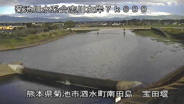 Sample August 2026
Watch it here
Play the stream
Nothing is requested from YouTube until you press it. What plays is the operator's own stream; this site neither records nor rebroadcasts it.
What you are looking at
Rice-growing is old in this basin partly as a gift of the volcano. River water reaches soil formed from accumulated ash carried down from Aso. Paddies fill everything outside the levees because that combination has held for more than a thousand years, and what occupies more of the frame than the river usually is the fields.
The season shows in the colour of the paddies. In spring they are flooded and shining, in summer green, in autumn cut and brown. It is a river where the change around it is larger than the change in it.
The source is Mount Miba, on the north side of the Aso outer rim. The river collects the streams falling from that rim, passes through Kikuchi, takes in the Koshi and others and comes out onto the Tamana plain. It runs 71 kilometres over 996 square kilometres with about 210,000 people, across the two prefectures of Kumamoto and Oita. That the water comes from Aso tells in the soil of the basin as well.
Rain in this basin falls long rather than hard. The usual pattern is the rainy-season front settling in and raining on, and the serious floods of the past are concentrated in that season. The flood of July 1990 was the largest on record and inundated a wide area; in June 1953 seven people died and over 15,000 houses were flooded. That it coincides with the season the paddies are under water is what makes this river awkward.
The mouth is the Ariake Sea, so the tide moves the downstream level too. Rain moves it at the end of the rainy season and in typhoons. Leave evacuation decisions to the local authorities. The feed rotates between points.
About this camera
| Place | Tamana, Kumamoto |
| Format | Live video, rotating |
| Time zone | Asia/Tokyo (UTC+9) |
| Category | River |
| Operator | MLIT river live streams |
| Terms of use | Government Standard Terms 2.0 |
The operator's own page
The footage belongs to each agency. This site is an unofficial guide, and each sample frame was copied once per camera under that agency's terms of use.
Cameras nearby
- Shira RiverKumamotoLive video, rotating
- Midori RiverUto, KumamotoLive video, rotating
- Kuma RiverHitoyoshi, KumamotoLive video, rotating
- Mount Nakadake and Kusasenri, AsoAso, KumamotoLive video
- Kusasenri, Mount AsoAso, KumamotoStill, every 2 min
- Mount Nekodake from Minami-AsoMinami-Aso, KumamotoStill, hourly