Live camera
Oita River live camera — Oita
From the foot of Mount Yufu down to Beppu Bay. Through the city the levees are close in, putting streets and water in the same frame.
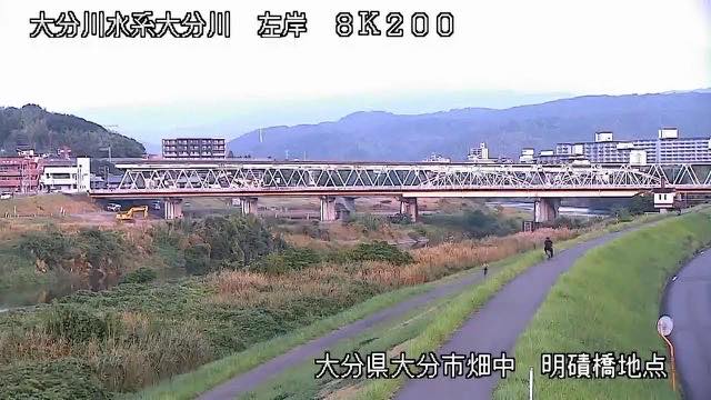 Sample August 2026
Watch it here
Play the stream
Nothing is requested from YouTube until you press it. What plays is the operator's own stream; this site neither records nor rebroadcasts it.
What you are looking at
This river comes out of country where the heat underground is close to the surface. Both the basin at its source and the shore of the bay below are known for hot springs, and the river runs past the skirts of volcanoes on its way to the sea. In the urban stretch, buildings press right up to the outside of the embankment, so water and town sit in one frame and, when the level rises, the distance to people's lives is visible as it is.
The Ono River, which reaches the same bay, draws its water from elsewhere. Open the two together and you can see that the same rain does not raise them in step.
The source is Mount Yufu in Yufuin, 1,583 metres. The river cuts through the Yufuin basin, takes in the Asono and the Serikawa, comes down the gorge of its middle course and enters the Oita plain at Hasama. It runs 55 kilometres over a basin of 650 square kilometres with about 260,000 people. The whole basin is contained inside Oita Prefecture.
This river turns rough when a typhoon passes up the Hyuga Sea on the eastern side of Kyushu. Even when the track is over Shikoku, moist air flows in against the mountains and becomes heavy rain. In the flood of September 1993, Oita had 81.5 millimetres in an hour and 414 in a day, both near the top of the record. It floods in the rainy season too, but the typhoon season brings the larger events.
The end of the rainy season and typhoons move it most. Oita is on Kyushu's eastern side, and it rains here even when a typhoon passes on the Shikoku side. Leave evacuation decisions to the local authorities.
About this camera
| Place | Oita |
| Format | Live video, rotating |
| Time zone | Asia/Tokyo (UTC+9) |
| Category | River |
| Operator | MLIT river live streams |
| Terms of use | Government Standard Terms 2.0 |
The operator's own page
The footage belongs to each agency. This site is an unofficial guide, and each sample frame was copied once per camera under that agency's terms of use.
Cameras nearby
- Ono RiverOitaLive video, rotating
- Bansho RiverSaiki, OitaLive video, rotating
- Mount Tsurumi and Mount GaranOitaStill, every 2 min
- Mount KujuOitaStill, every 2 min