Live camera
Bansho River live camera — Saiki, Oita
A clear river emptying into Saiki Bay. On clear days you can make out changes in the colour of the riverbed from the camera.
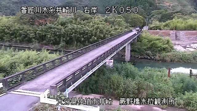 Sample August 2026
Watch it here
Play the stream
Nothing is requested from YouTube until you press it. What plays is the operator's own stream; this site neither records nor rebroadcasts it.
What you are looking at
The water is clear because the catchment is short and the distance from mountain to sea is small. With no broad plain upstream, it reaches the mouth with little mixed into it. For the same reason, though, the level rises quickly once rain starts. The clarity and the abruptness come from the same terrain.
Beyond the mouth is a ria coast, where the mountains drop straight into the sea. The shortness of the river is part of that same landform.
The source is Mikuni Pass in Saiki. The channel is 38 kilometres and the basin 464 square kilometres, roughly a triangle 30 kilometres east to west and 25 north to south, with about 54,000 people. Upstream there are many steep mountains of 400 to 500 metres and the river makes a winding gorge. There is a limestone belt in the headwaters of a tributary, and karst landforms can be seen there.
What moves this river is almost always a typhoon. The typhoon of 1943 left 48 dead or injured and 21 missing, and washed away 143 houses. In recent years too, water has come over the banks of the main channel and of the Kurusu tributary with each typhoon: September 1997, October 2004, September 2005, September 2017. The basin is small and steep, so this is a river to watch from the moment a typhoon's approach is announced.
On a clear day with clear water, the riffles and the pools show different colours on the bed. At the end of the rainy season and in typhoons the level moves within hours. Leave evacuation decisions to the local authorities. The feed rotates between points.
About this camera
| Place | Saiki, Oita |
| Format | Live video, rotating |
| Time zone | Asia/Tokyo (UTC+9) |
| Category | River |
| Operator | MLIT river live streams |
| Terms of use | Government Standard Terms 2.0 |
The operator's own page
The footage belongs to each agency. This site is an unofficial guide, and each sample frame was copied once per camera under that agency's terms of use.
Cameras nearby
- Mount Tsurumi and Mount GaranOitaStill, every 2 min
- Mount KujuOitaStill, every 2 min
- Oita RiverOitaLive video, rotating
- Ono RiverOitaLive video, rotating