Live camera
Kimotsuki River live camera — Osumi Peninsula, Kagoshima
It crosses the Osumi plain to Shibushi Bay. Ash from Sakurajima sometimes washes into it.
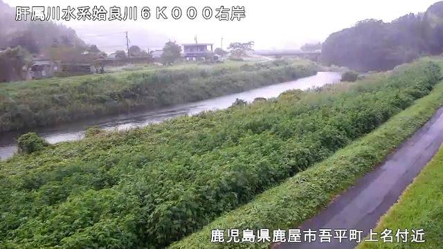 Sample August 2026
Watch it here
Play the stream
Nothing is requested from YouTube until you press it. What plays is the operator's own stream; this site neither records nor rebroadcasts it.
What you are looking at
What spreads around this river is a whitish plateau built up from volcanic ejecta. It lets water through easily, so rain does not stay in the ground: it drains down and comes out into this river all together. That is why the plateau above is short of water while the water gathers in the river. After an eruption, ash washing in can also make the water turbid.
Being a peninsular river, its catchment is narrow. The distance from headwaters to mouth is short, and rain comes straight through into the level.
The source is Mount Ontake in the Takakuma range, at 1,182 metres. The river cuts through the town of Kanoya, takes in the Aira, the Koyama and the Kushira, comes down the Kimotsuki plain and goes out to Shibushi Bay. It is only 34 kilometres long, but it draws on a basin of 485 square kilometres with over 115,000 people. People and farmland sit densely on a short river.
Mean annual rainfall in the basin is about 2,800 millimetres, over 1.6 times the national average. And the Osumi peninsula is typhoon country: about seventy per cent of this river's major floods came from typhoons. The typhoon of 1938 left 259 dead or missing. The rainfall itself is heavy here, so the level rises whenever a front settles in, typhoon or not.
Typhoons in August and September move it most. Southern Kyushu has more typhoon landfalls than anywhere in Japan. The rougher the day, the darker the picture. Leave evacuation decisions to the information from local authorities.
About this camera
| Place | Osumi Peninsula, Kagoshima |
| Format | Live video, rotating |
| Time zone | Asia/Tokyo (UTC+9) |
| Category | River |
| Operator | MLIT river live streams |
| Terms of use | Government Standard Terms 2.0 |
The operator's own page
The footage belongs to each agency. This site is an unofficial guide, and each sample frame was copied once per camera under that agency's terms of use.
Cameras nearby
- Cranes on the Izumi plainIzumi, KagoshimaStill, hourly
- Sakurajima surveillance camerasKagoshimaStill image
- Sakurajima (JMA camera)KagoshimaStill, every 2 min
- Satsuma IwojimaKagoshimaStill, every 2 min
- KuchinoerabujimaKagoshimaStill, every 2 min
- NakanoshimaKagoshimaStill, every 2 min
- SuwanosejimaKagoshimaStill, every 2 min
- Sendai RiverKagoshima / MiyazakiLive video, rotating