Live camera
Mount Kanaga live camera — Alaska
A symmetrical 1,307 m cone. Its summit crater is about 200 m across and 60 m deep, with active fumaroles inside.
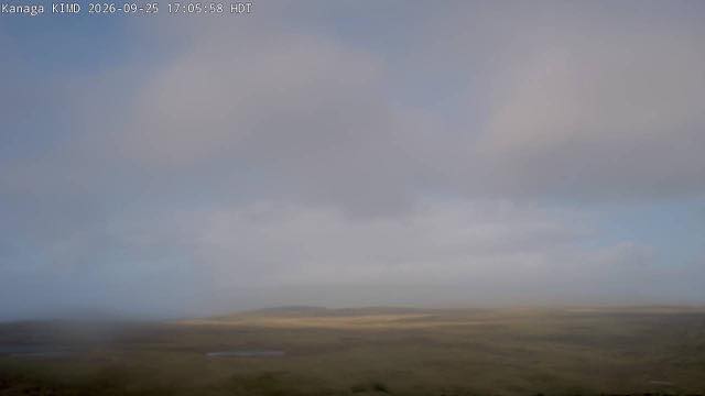 Sample September 2026
What you are looking at
Tundra of yellowed dry grass spreads in the foreground, with a small pond in a hollow. Behind it is thick cloud, and the mountain itself does not appear. This sample image was caught on a cloudy day.
Kanaga is a 1,307-metre symmetrical cone on the western side of the Aleutian chain. A crater 200 metres across and 60 metres deep sits at its summit, and fumaroles are at work inside it. On days when it shows, that cone stands in the middle of the frame.
The Aleutians get a great deal of fog and low cloud, and days when the mountain is hidden are if anything the more common. A frame that is nothing but white does not mean the equipment has stopped.
The camera itself stands on Adak, the island next door to the east, which is the westernmost town in the United States. A naval base was built here during the Second World War and some six thousand people once lived on the island; since the base closed in 1997 the population has been under two hundred. The runway and the communications plant survive from that era, which is why pictures get out from an island this remote at all. Kanaga last erupted in 1994 and 1995.
A still camera. Eighteen hours behind Japan on summer time, nineteen on winter time. Three in the morning Japan time (four on winter time) is nine in the morning there.
About this camera
| Place | Alaska |
| Format | Still image |
| Time zone | America/Anchorage (UTC-9, DST UTC-8) |
| Category | Volcano |
| Operator | Alaska Volcano Observatory |
| Terms of use | Free to use with credit |
The operator's own page
The footage belongs to each agency. This site is an unofficial guide, and each sample frame was copied once per camera under that agency's terms of use.
Cameras nearby
- Bald eagle nestWest VirginiaLive video
- Mammoth Hot SpringsWyomingStill image
- Electric PeakWyomingStill image
- Mount WashburnWyomingStill image
- Grand CanyonArizonaStill image
- Acadia National ParkMaineStill image
- Kilauea, Halemaumau CraterHawaii IslandLive video
- Rocky Mountain National ParkColoradoStill image