Live camera
Lake Mývatn, looking southeast live camera
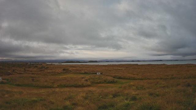
A shallow lake dammed by lava, with low islands scattered across it and marsh and grassland along the shore. It is known for the number of waterbirds it holds. The camera looks southeast across the water.
 Sample September 2026
What you are looking at
Marsh and grassland in the foreground, with the lake’s surface entering beyond it as a long horizontal band. Low islands float on it, dotting the line between water and sky. There are no high mountains at its shore, and the frame divides into sky and flat ground.
Lake Mývatn is a shallow lake formed when a broad flow of lava dammed a valley. Because what dammed it was lava rather than debris, the mountain responsible is not in the frame, and the result is this flat sheet of water. Its shores are marsh and grassland, and it is known for its waterfowl.
The camera faces southeast across the lake. It sits at an Icelandic Met Office station and is there to measure the weather, not to show the view.
Mývatn means “midge lake”, after the insects that swarm here in summer. The midges feed the waterbirds, so the name and the abundance of birds come from the same cause. Along the southern shore stand rows of pseudocraters: holes left where steam escaped as lava ran over wet ground. They have the shape of a vent, but no conduit for magma beneath.
A still image, replaced every ten minutes. Nine hours behind Japan, with no summer time.
About this camera
| Place | Mývatn, northeast |
| Format | Still, every 10 min |
| Time zone | Atlantic/Reykjavik (UTC+0) |
| Category | Nature |
| Operator | Icelandic Meteorological Office |
| Terms of use | Free to use with credit |
The operator's own page
The footage belongs to each agency. This site is an unofficial guide, and each sample frame was copied once per camera under that agency's terms of use.
Cameras nearby
- Mánárbakki, looking northeastTjörnes peninsula, northeastStill, every 10 min
- Reykjavík, looking northReykjavíkStill, every 10 min
- HveravellirCentral HighlandsStill, every 10 min
- Höfn, looking northHornafjörður, southeastStill, every 10 min
- Surtsey, looking northeastVestmannaeyjar, off the south coastStill, every 10 min