Live camera
Shinsuna emergency wharf live camera — Koto, Tokyo
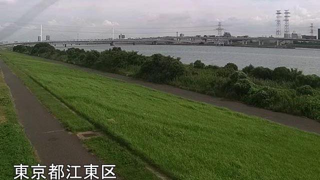
The marker here reads -0.5 km, the closest the Arakawa gets to the sea. This stretch is tidal, and the level rises and falls within the day.
 Sample August 2026
What you are looking at
The distance marker reads "-0.5k". This is where the Arakawa comes closest to the sea, and the furthest downstream of the Arakawa cameras here.
The number is negative because the point sits seaward of where the markers start counting. This reach is tidal, so the water level rises and falls through the day even with no rain. Open it twice a few hours apart and the shoreline can look different. Flood water and tide both raise the level, which makes a day when heavy rain meets high tide the highest water of all.
Along this stretch the Arakawa is a floodway dug by hand to send floods out to sea instead of through the city, and this is its outlet.
The suna in Shinsuna comes from Sunamura Shinzaemon, who reclaimed this ground in the early Edo period. The new fields made from the sea later became known for forcing vegetables under hotbeds, supplying the city with the first produce of the season. Of those fields, only the place name is left.
The far bank is lined with warehouses and factories on reclaimed land, and beyond them is Tokyo Bay.
The still refreshes every minute. The river runs north to south, so the surface blows out white by day and the far bank reads best morning and evening.
About this camera
| Place | Koto, Tokyo |
| Format | Still, every minute |
| Time zone | Asia/Tokyo (UTC+9) |
| Category | River |
| Operator | MLIT Arakawa Downstream River Office |
| Terms of use | PDL 1.0 |
The operator's own page
The footage belongs to each agency. This site is an unofficial guide, and each sample frame was copied once per camera under that agency's terms of use.
Cameras nearby
- Shinjuku Station EastShinjuku, TokyoLive video
- Izu OshimaOshima, TokyoStill, every 2 min
- NiijimaNiijima, TokyoStill, every 2 min
- KozushimaKozushima, TokyoStill, every 2 min
- MiyakejimaMiyake, TokyoStill, every 2 min
- HachijojimaHachijo, TokyoStill, every 2 min
- AogashimaAogashima, TokyoStill, every 2 min
- Iwabuchi FloodgateKita, TokyoStill, every minute