River
The Yura River: 1 Live Camera in Japan
A Kyoto Prefecture river running from the Fukuchiyama basin down to the Sea of Japan, on a Ministry of Land, Infrastructure and Transport live stream. Long stretches have low banks, and the water level is watched closely whenever it rains hard.
What you can see
The Yura crosses Kyoto Prefecture almost north to south. It rises in the Tanba hills, spreads out through the Fukuchiyama basin, then threads between mountains to reach the Sea of Japan.
What defines it is how little the lower channel falls. Close to the sea the bed barely drops, so water gathering from upstream is slow to drain and the low-banked stretches go first. In the 2004 typhoon Tokage, a tourist bus was caught in the floodwater here and its passengers waited on the roof to be rescued.
The stream is a rotating one: a single feed cycles through a series of points along the river, so you wait for the spot you want to come round.
The gentle gradient downstream continues into how low this river system is further up. The divide between the Yura's basin and that of the Kako, which drains to the Seto Inland Sea, lies at Iso in Tamba, Hyogo Prefecture. It stands about 95 m above sea level — the lowest point in the country at which the Sea of Japan and Pacific sides of Honshu part. The waters are not separated by a range; they choose their destination at close to lowland height. That the Yura reaches the sea without cutting deep into mountains is an extension of that lowness.
Cameras you can watch now: 1
All 1 are live video. Tap one to open it in the camera list.
-
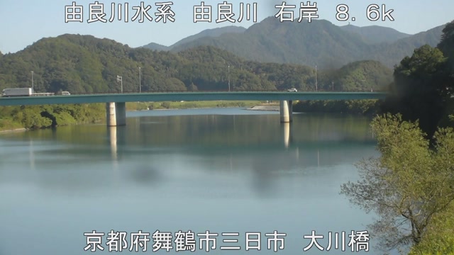 Sample October 2026
Yura River
Fukuchiyama–Maizuru, Kyoto · River
From the Fukuchiyama basin down to the Sea of Japan. Long stretches have low levees, so the level is watched closely whenever it rains hard.
When to watch
On an ordinary day, morning. This is a basin river, and from autumn into winter mist rises off the water — the Fukuchiyama basin fogs readily, and the clearer the night, the thicker it gets.
The water rises in the rainy season and typhoon season, but the rougher the day the darker the picture and the more the rain blurs the lens. Take evacuation decisions from your local authority, not from here. These cameras are for seeing what things look like.
The feed is experimental and can stop without notice.
If it isn't showing
This is a cycling feed: one video steps through a number of points along the river in turn. You wait for the place you want, and you cannot choose the order. The rougher the day, the darker the picture and the more the rain smears the lens. The feed is a trial service and can stop without notice.
Kyoto has 34 cameras, but only three of them look at rivers — the Yura, the Katsura and the Kizu. The rest are shrines, temples and streets. The Kyoto page lists all of them, so this page is the faster way in when rivers are what you want. The Katsura and the Kizu run down to the Yodo and are gathered on The Yodo River System; the Yura, which goes out to the Sea of Japan, is separated out here.
Within the same prefecture this is nothing like a quiet garden such as Kyoto Imperial Garden — here the volume of water is the subject. The other rivers of Kansai are written up on The Yamato River, The Rivers of the Kii Peninsula and Rivers and Coast in Hyogo.
Where to find The Yura River
Agencies publishing the cameras on this page
- MLIT river live streams (Government Standard Terms 2.0) — Official site
The footage belongs to each agency. This site is an unofficial guide, and each sample frame was copied once per camera under that agency's terms of use.